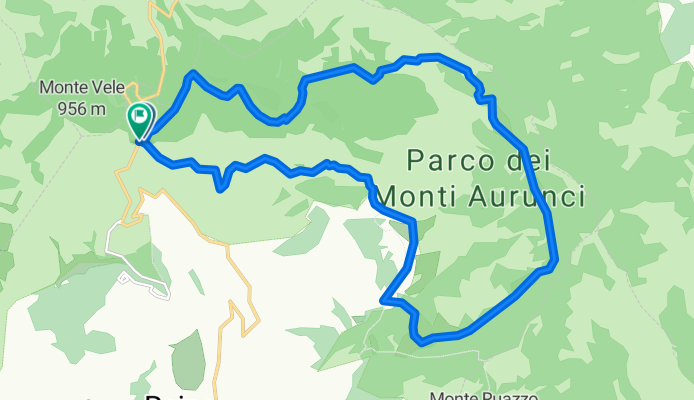
Cycling Route in Campodimele, Latium, Italy
S. Nicola - Piana di Campello - Valle Trasta

Open this route in Bikemap Web
Distance
Ascent
Descent
Duration
Avg. Speed
Max. Elevation
Cycling Route in Campodimele, Latium, Italy

Open this route in Bikemap Web
GUIDA AI PERCORSI IN MOUNTAINBIKE nel Parco Naturale dei Monti Aurunci
PERCORSO n° 6
Percorso ad anello che si inoltra nel cuore del Parco, attraversando luoghi di notevole pregio paesaggistico.
Rimanendo pressochè a quota costante presenta tutte le difficoltà tipiche del Mountain Biking.
Il tempo di percorrenza è di circa 2h 14'.
(Il percorso segnalato è esemplificativo, informazioni ulteriori nella Guida ai Percorsi in Mountainbike nel Parco Naturale dei Monti Aurunci).
Fonte di Acqua Potabile

You can use this route as a template in our cycling route planner so that you don’t have to start from scratch. Customize it based on your needs to plan your perfect cycling tour.